Maps
Explore our Region
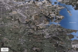
This aerial map shows the Bay Area Houston region including BAHEP’s member cities.
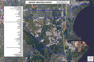
Bayport Industrial District Industries
The Bayport Industrial District is a large commercial real estate development. Created in 1970, it is among the largest private industrial complexes in the United States. Companies from every corner of the globe call the Bayport District’s 12 square miles / 8,500 acres home.
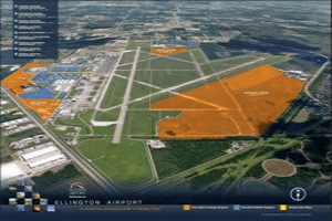
This aerial map of Ellington Airport gives a description of large airport property, parceled aviation property, and road & taxi ways.

Houston Ship Channel Industries
The Houston Ship Channel is one of the busiest waterways in the United States and the home of the petrochemical capital of the world.

This map of Bay Area Houston shows the demographics of the region in a 3, 5 or 7 mile radius. Demographics include: Population, Households, Average Household Income, Median Household Income, Median Household Disposable Income, and Daytime Employee Population.
